|
Orienteering
What is Orienteering?
 Orienteering is a running sport involving navigation
with a map and compass. The traditional form (sometimes referred to as
"Foot Orienteering" or "Foot-O") involves cross-country running, though
other forms have evolved. The competition is a timed race in which
individual participants use a special purpose map and a magnetic compass
to navigate through diverse terrain (often wooded) and visit, in
sequence, control points that are indicated on the map. The course of
control points is kept secret from the competitors, until the start,
when they are provided with a detailed topographic map on which the
course is marked. Competitors start at staggered intervals, are
individually timed, and are expected to perform all navigation skills on
their own. Standings are determined first by successful completion of
the course, then by shortest time on course. Rules and principles of the
sport are defined by the International Orienteering Federation. Orienteering is a running sport involving navigation
with a map and compass. The traditional form (sometimes referred to as
"Foot Orienteering" or "Foot-O") involves cross-country running, though
other forms have evolved. The competition is a timed race in which
individual participants use a special purpose map and a magnetic compass
to navigate through diverse terrain (often wooded) and visit, in
sequence, control points that are indicated on the map. The course of
control points is kept secret from the competitors, until the start,
when they are provided with a detailed topographic map on which the
course is marked. Competitors start at staggered intervals, are
individually timed, and are expected to perform all navigation skills on
their own. Standings are determined first by successful completion of
the course, then by shortest time on course. Rules and principles of the
sport are defined by the International Orienteering Federation.
The English name derives from the Swedish word "orientering".
The term was first used to describe the sport in 1918 by Major Ernst
Killander, then President of the Stockholm Amateur Athletic Association,
in publicity for the first large scale competitive meet held in Sweden.
History
Early days
Orienteering originated in Sweden, as a military exercise, in the late
19th century. The competitive sport form began in Sweden where the first
competition was held for officers on 28 May 1893 at the yearly games of
the Stockholm garrison. The first civilian competiton took place in
Norway on 31 October 1897. It was sponsored by the Tjalve Sports Club
and held near Oslo. The course was quite long by modern standards, at
19.5 km, on which only three controls were placed. Peder Fossum won the
event in a time of 1 hour, 47 minutes, and 7 seconds. The first large
scale orienteering meet was organized in 1918 by Major Ernst Killander
of Stockholm, Sweden. Killander was a Scout leader who turned to the
sport as an opportunity to interest youth in athletics. The first large
scale event was organized south of Stockholm and was attended by 220
athletes. Killander continued to develop the rules and principles of the
sport, and today is widely regarded throughout Scandinavia as the
"Father of Orienteering".
The sport gained popularity with the development of
more reliable compasses in the 1930s. The first international
competition between orienteers of Sweden and Norway was held outside
Oslo, Norway in 1932. In 1933, the Swedish compass manufacturer Silva
Sweden AB introduced a new compass design, the protractor compass. Until
the development of thumb compasses, the protractor compass would remain
the state of the art in the sport. By 1934, over a quarter million
Swedes were actively participating in the sport, and orienteering had
spread to Finland, Switzerland, the Soviet Union, and Hungary. The
nations of Finland, Norway, and Sweden all established national
championships. The Swedish national orienteering society, Svenska
Orienteringf?rbundet, the first national orienteering society, was
founded in 1936.
Post war years
Following World War II, orienteering spread throughout Europe, Asia,
North America, Australia, and New Zealand. The first orienteering event
in North America took place in November, 1941, held by Dick Smith at
Dartmouth College, in Hanover, New Hampshire, USA, organized by Piltti
Heiskanen, a visiting teacher from Finland. Bjorn Kjellstrom (d. 1995),
a Swedish orienteering champion and co-founder of compass manufacturer
Silva Sweden AB, moved to the United States in 1946 to found the U.S.
operations of The Silva Company (later Silva, Inc.). Kjellstrom brought
his love for orienteering with him, inaugurating Silva Orienteering
Services to provide training and company sponsorship for the sport.
Norwegian Harald Wibye in 1967 founded the first U.S. orienteering club,
the Delaware Valley Orienteering Association, now the largest in the
United States. The Canadian Orienteering Federation was also founded in
1967, and the first Canadian national orienteering championship was held
at Gatineau Park in Ottawa on August 10, 1968. In 1971 a group of
orienteers led by members of the four-year old Quantico Orienteering
Club founded the U.S. Orienteering Federation. The only World
Championship to be held in North America took place at Harriman State
Park, New York, USA in 1993.
Eleven countries sent representatives to an
international conference in Sandviken, Sweden in 1949 that aimed to
bring more consistent rules and mapping standards to the sport. The
Norwegians and Swedes began producing new multi-color maps designed
specifically for orienteering, in the 1950s. The first orienteering
event in Australia was held in 1955. The International Orienteering
Federation (IOF) was established in 1961 and the first world
championships were held in 1966. The founding member societies
represented the nations of Bulgaria, Czechoslovakia, Denmark, the
Federal Republic of Germany, the German Democratic Republic, Finland,
Hungary, Norway, Sweden, and Switzerland. By 1969, the IOF would
represent 16 countries, including the first two non-European member
societies representing Japan and Canada.
Recent years
Sixty-seven different national orienteering federations are member
societies of the IOF today. World championships were held biannually
from 1961 to 2003, and are now held every year. Jukola relay and Tiomila
have both been held since the 1940s. The largest individual orienteering
meet, O-Ringen, has been held annually since 1965 and attracts around
15,000 athletes to compete in the Swedish forests. There are new
variations of the sport, including ski orienteering, mountain bike
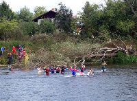
orienteering, trail orienteering, canoe orienteering, and radio
orienteering that attract diverse communities of athletes. The sport has
been dominated by the Nordic nations and Switzerland, but increasingly
France, United Kingdom and several Eastern European countries are making
their mark. Outside Europe, Australia and New Zealand are the most
developed orienteering nations. After the death of Bjorn Kjellstrom and
the absence of active corporate sponsorship, U.S. orienteering has
remained somewhat stagnant in terms of participation in recent years.
Orienteering and the Olympics
An orienteering course is marked in purple or red on a map using a
triangle to indicate the start and a double circle to indicate the
finish. Circles are used to show the control points. A staggered start
is often used, with competitors starting at one or two-minute intervals.
Results are based on the time taken to complete the course, visiting all
the controls in the correct order.
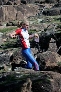
High levels of fitness and running speed are required
to compete successfully at an elite level. Success is also heavily
dependent on choosing the fastest route between controls. While controls
are generally the same for the competitors in any particular category,
the routes they choose may be very different. Competitors are often
required to cross rough, undeveloped terrain where accurate navigation
is essential.
Orienteering races usually offer a range of courses
with varying physical and technical difficulty to appeal to competitors
of differing abilities. Often courses are classified by age class, e.g.,
M35 for men 35 years of age and older. Sometimes several courses are
available for each age class, e.g., W18L: women 18 years and younger
long course, W70S: women over 70 short course, M21E: men's open elite
etc.
Some countries, such as the United States or the
United Kingdom, use color-coded courses at smaller races to define the
difficulty of the courses. A "white" course, for instance, might be a
short, easy course aimed at beginners whilst a "blue" course would be
both technically and physically more demanding.
Recently some local orienteering clubs have begun to
organize orienteering courses solely for fitness purposes. These may be
permanent courses, and are used for practice and training. Maps of the
courses are usually available publicly for a fee. Sometimes these are
collected back after completing the course and certainly so if the
course is later intended also for major event. All major competitive
events should have completely new control points on the course, and the
general area of the competition can be closed for competitors during the
construction of the course.
Map and control details
 Maps are specially created by orienteers and professional mapmakers.
They are a larger scale and much more detailed than general-purpose
topographic maps, and are typically at scales of 1:15,000 or 1:10,000,
with grids predrawn to magnetic north. Map symbols for the 1:15000 scale
are standardized by the IOF (International specification for
orienteering maps - ISOM), and designed to be readable by any competitor
no matter his background or native tongue. 1:15,000 is specified to be
the norm and 1:10,000 a special-purpose variation, and map symbols for
the 1:10000 scale are required by the specification to be a 150%
enlargement of the symbols for the 1:15,000 scale. However in some
countries almost all maps used are at 1:10,000 using symbols at the
regular size. Maps are specially created by orienteers and professional mapmakers.
They are a larger scale and much more detailed than general-purpose
topographic maps, and are typically at scales of 1:15,000 or 1:10,000,
with grids predrawn to magnetic north. Map symbols for the 1:15000 scale
are standardized by the IOF (International specification for
orienteering maps - ISOM), and designed to be readable by any competitor
no matter his background or native tongue. 1:15,000 is specified to be
the norm and 1:10,000 a special-purpose variation, and map symbols for
the 1:10000 scale are required by the specification to be a 150%
enlargement of the symbols for the 1:15,000 scale. However in some
countries almost all maps used are at 1:10,000 using symbols at the
regular size.
Map reading and terrain association are supreme in
orienteering navigation, and the compass is normally reduced solely to
the role of orienting the map to magnetic north.
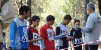
Control points are usually placed on distinct
features, and clarified on a "control description sheet". They are
marked in the terrain by white and orange (or white and red) flags, like
that illustrated above. A competitor registers his or her visit by
punching a "control card" with a needle punch, or using an electronic
chip.
Equipment and clothing
 The basic equipment required for orienteering is usually listed as
compass, appropriate outdoor clothing and, in some countries, whistle.
The whistle is for use in emergency situations. Competitive orienteers
usually use specialized equipment, such as a "thumb compass". A clear
plastic sleeve is often worn on the forearm to hold control
descriptions. Competitors may also use a "punch-card holder" for
hands-free orienteering. A modern variation on the punch card is
electronic punching. There are two types of electronic punching. The
SPORTIdent system uses a small plastic 'e-card' (also called a 'dibber'
or 'fingerstick'), which straps to a competitor's finger and is inserted
into a special, battery-operated station at the control point. The other
is a system known as 'EMIT' which has more of a brick-like shape, but
follows the same principle as the 'e-card' with the added backup of a
small paper card. This card is pierced by a pin in a specific location
at each station. With both, the time at which the control was punched is
recorded. Some electronic punching systems have stations that beep
and/or flash a light to notify that the punch is OK. For important
events there should be some kind of independent backup available in case
of equipment failure. The basic equipment required for orienteering is usually listed as
compass, appropriate outdoor clothing and, in some countries, whistle.
The whistle is for use in emergency situations. Competitive orienteers
usually use specialized equipment, such as a "thumb compass". A clear
plastic sleeve is often worn on the forearm to hold control
descriptions. Competitors may also use a "punch-card holder" for
hands-free orienteering. A modern variation on the punch card is
electronic punching. There are two types of electronic punching. The
SPORTIdent system uses a small plastic 'e-card' (also called a 'dibber'
or 'fingerstick'), which straps to a competitor's finger and is inserted
into a special, battery-operated station at the control point. The other
is a system known as 'EMIT' which has more of a brick-like shape, but
follows the same principle as the 'e-card' with the added backup of a
small paper card. This card is pierced by a pin in a specific location
at each station. With both, the time at which the control was punched is
recorded. Some electronic punching systems have stations that beep
and/or flash a light to notify that the punch is OK. For important
events there should be some kind of independent backup available in case
of equipment failure.
Purpose-made lightweight nylon or lycra suits provide
full body cover for racing in areas with undergrowth. Gaiters are also
often worn. Lightweight studded (and often cleated) orienteering shoes
are commonly used. People sometimes wear visors to keep rain, dust and
twigs out of their eyes. GPS and other electronic navigation devices are
not normally allowed.
Recognized types of orienteering
The four types of orienteering recognized by the International
Orienteering Federation are foot orienteering, mountain bike
orienteering, ski orienteering, and trail orienteering.
Mountain bike orienteering
This is orienteering on a mountain bike, abbreviated MTBO or MTB-O. As
bikes are usually not permitted to leave the path system, the major
focus becomes route choice while navigating at bike speed. Special
equipment required is a map holder attached to the handlebar of the
bike. Maps are usually smaller scale and less detailed than standard
orienteering maps.
Ski orienteering
Another variant includes orienteering on cross-country skis. Standard
orienteering maps are used, but with special green overprinting of
trails and tracks to indicate their navigability in snow; other symbols
indicate whether any roads are snow-covered or clear. Standard
cross-country ski equipment is used, along with a map holder attached to
the chest.
Trail orienteering
An orienteering form accessible to disabled competitors on equal terms
as ablebodied, where the object is accuracy, not time. It involves
determining, along an accessible course no competitor may leave, which
of various controls in a small area is the one indicated on the map.
Another less common form involves determining the position on a map of a
control viewed from a set point 30-40 metres away. Maps are usually
1:5,000 scale
|